The Neighborhood: Difference between revisions
No edit summary |
No edit summary |
||
| (5 intermediate revisions by the same user not shown) | |||
| Line 1: | Line 1: | ||
When the Longnecker House was built in 1898, this area was just being built up and "town" was considered 1/2 mile to the west where the downtown core is located to this day. | When the Longnecker House was built in 1898, this area was just being built up and "town" was considered 1/2 mile to the west where the downtown core is located to this day. | ||
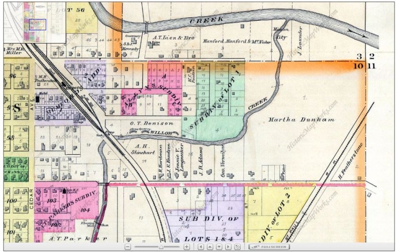
In the 1895 Atlas, there were only a couple of houses on the south side of the street and the property to the east was still a farm with no street between | In the 1895 Atlas, there were only a couple of houses on the south side of the street and the property to the east was still a farm, owned by Martha Dunham, with no street between that and the George Vermilya property, which would be divided to create the lot for the Longnecker house in 1898. | ||
Note in the map below that J. Longnecker is shown owning a lot with two houses built on it a couple of properties to the west. | |||
The town grew rapidly after that, and now the Longnecker House is firmly in the middle of town, albeit on a more generous lot than most other houses built afterwards. | [[File:1895Atlas.JPG|800px|1895 Atlas]] | ||
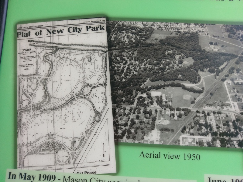
By 1909, the Dunham farm was turned into City Park with Oak Street extended to accessed it, thereby separating the former farm from the Longnecker property, which thus became a corner lot. | |||
[[File:IMAG0409.jpg|800px|1909 Plat of City Park, now called East Park, and 1950s aerial view]] | |||
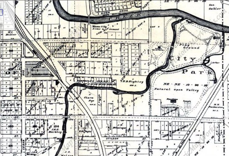
The town grew rapidly after that, and now the Longnecker House is firmly in the middle of town, albeit on a more generous lot than most other houses built afterwards. Interestingly, the map continues to show the full Vermilya lot 14 years after the lot for the Longnecker house was divided off, although the original J. Longnecker lot to the west has been subdivided. | |||
[[File:1912CityDetailClipped.jpg|800px|1912 City Map]] | |||
Latest revision as of 21:08, 10 April 2020
When the Longnecker House was built in 1898, this area was just being built up and "town" was considered 1/2 mile to the west where the downtown core is located to this day.
In the 1895 Atlas, there were only a couple of houses on the south side of the street and the property to the east was still a farm, owned by Martha Dunham, with no street between that and the George Vermilya property, which would be divided to create the lot for the Longnecker house in 1898.
Note in the map below that J. Longnecker is shown owning a lot with two houses built on it a couple of properties to the west.
By 1909, the Dunham farm was turned into City Park with Oak Street extended to accessed it, thereby separating the former farm from the Longnecker property, which thus became a corner lot.
The town grew rapidly after that, and now the Longnecker House is firmly in the middle of town, albeit on a more generous lot than most other houses built afterwards. Interestingly, the map continues to show the full Vermilya lot 14 years after the lot for the Longnecker house was divided off, although the original J. Longnecker lot to the west has been subdivided.


